Sometimes all it takes is a little kernel of inspiration to lead you down a path to something unimaginably difficult. For me, it was the brief nostalgic mention of Mt. Rainier by a friend and how he had always wished he had climbed this classic route on the north face of the mountain. A little research showed me that Liberty Ridge is a super classic mountaineering route, celebrated by climbers the world over. I decided to put a trip together and invited my climbing partners from the previous winter of getting blasted by wind in Colorado; Adam, Mike and Erik.
Liberty Ridge itself rises nearly 7000 vertical feet from the Carbon Glacier to the Liberty Cap summit. If the elevation gain wasn't enough, the last pitch of the ridge is made of 60 degree alpine ice; a mountaineer's treat. Apart from the standard glacier hazards of Mt. Rainier and the long approach, Liberty Ridge is special; a stunning line that separates the active and dangerous Liberty and Willis Walls. During our climb, near-constant rockfall, icefall and avalanches could be seen on these walls from the safety of the ridge.
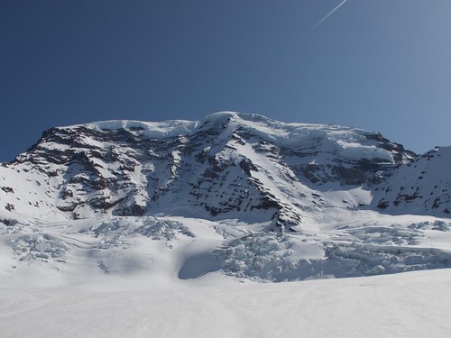
Liberty Ridge on the North Face of Mt. Rainier flanked on the left by the Willis Wall and the right by the Liberty Wall. Both walls are capped by a summit glacier that regularly calves off car- and house-sized blocks of ice.
Tactics:
We all knew the seriousness of this climb and had many months to plan out the little details. Reinhold Messner gave me good perspective from reading about his trans-Antarctica trek (Antarctica: Both Heaven and Hell) when we stressed that good tactics are more valuable than any amount of luck since they are all you can control. A few tactical items of note:
Timing of the Climb: I chose to submit a permit for Mother's Day weekend since there was the least chance of encountering other people while winter weather had begun to taper off. I faxed in my permit the first day it was possible (March 15th).
Guidebook: We used "Mount Rainier: A Climbing Guide" by Mike Gauthier and it provided useful and accurate information. We also read up about the climb on SummitPost and asked many mountain climber friends who had done it before for advice.
Food: Everyone brought breakfasts and lunches for 5 days and then each person brought one group dinner (plus an extra for emergencies). This prevented overpacking and gave us some variety.
Fuel: We brought 200 ml of fuel per person per day for 5 days (totaling 4 liters assuming a possible 5-day trip) as recommended by the NOLS Cookery book. None of our food required cooking (just rehydration), so our fuel was used primarily for melting snow. At the end of the trip, we decided that 150ml/person/day would have been plenty for what we used it for.
Stoves: We brought 1 MSR WhisperLite and 1 MSR SimmerLite. One stove was rendered useless when it was cleaned, so it was good we had two. Know how to clean your stove properly!
Sled: We brought a plastic sled and used slings to haul it down the road on the approach and retreat. This was invaluable as it made all our packs at least 10lbs lighter.
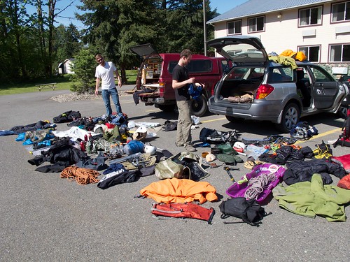
Group Gear: One of the most useful things we did in prep was for everyone to pack their packs for the climb, bring them to one of our houses and then dump them out on the floor. We would then nit-pick everyone's gear choices and remove redundant group gear. It was through this process that I was told to leave my extra pair of shoelaces to save weight....sigh....mountaineers...
Shelter: We used a Mega-Light (2lbs, one pole, fits 4 people, perfect for snow) and it worked GREAT. We had duct-tape on hand in case quick repairs were needed.
Snowshoes: We brought snowshoes, intending to leave them at the sled if necessary; we carried them to the summit and used them for much of the approach and retreat hiking. Just because you are in the Cascades doesn't mean the snow can't be a slushpile occasionally.
Tool Combinations: We all carried one mountain axe and one ice tool (with leashes for both) except for Adam due to his comfort level with not using a mountain axe. Having a tool you can plunge into deep snow and get good purchase is a very helpful thing to have. I did not regret my decision to not bring 2 ice tools.
SPOT Beacon: Once piece of gear that reduced the psychological severity of the climb was Adam's SPOT beacon. Every night he would send an "I'm Okay" message that was forwarded by email to all the females in our lives (mothers, GFs, fiances) so they could have peace of mind. Knowing that they knew we were okay helped us not worry that a rescue team might show up at the behest of a nervous significant other.
If you don't read anything else from this trip report, you should read that we were "given" a very special version of this route to climb. For 4 days of approaching and climbing, we had perfect bluebird weather. In 4 days of hiking in one of the most visited national parks in the country (~1.5 million visitors in 2011), we did not see a single other person. We spent 4 days breaking fresh tracks through perfect snow with no other humans in sight. This alone made the trip perfect, then there was the climb.
After two days of driving from Boulder, CO (road trip!) we arrived at a Forest Service road just outside the entrance to the park. We were lucky enough to arrive just as a high pressure system was beginning to settle over Mt. Rainier, we camped the night and it did not rain.
Day 1 - Trailhead to Glacier Basin
We woke up at 7AM and drove to the Sunrise Road. When my permit was being approved by the NPS, I was told by a ranger that the road would be closed approximately 6 miles from the standard trailhead at the White River Campground. After a winter of slogging up long approaches and retreats in the Indian Peaks, CO, I knew the team would have no problem with this extra distance.
At Adam's recommendation we brought along a plastic sled to haul sharps and heavies down the road. (Note to Arc'teryx, Mountain Hardware, etc: put your logo on a $10 Wal-Mart sled, call it a "gear sledge" and sell it for $200). We hiked the Sunrise Road to the ranger station, filled out the necessary permits and loaded the sled.
Note to Mount Rainier National Park: when we arrived at the station, there were NO BLUE BAGS available; we managed to improvise with plastic bags we brought, but if you want people to carry out their human waste, you should leave bags for those people.

Our gear sledge, complete with a sixer of Rainier Beer tallboys
We hiked the Sunrise Road for most of the morning, taking in the blue sky and our first views of the mountain.
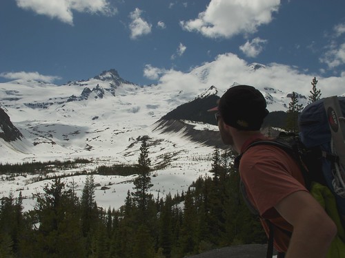
View of Mt. Rainier and the Emmons Moraine from near the White River Campground
We ditched the sled just past the White River campground and began to hike up the drainage to Glacier Basin. This approach involved multiple crossings of the upper reaches of the Inter Fork of the White River. We crossed in the stream as well as over snow bridges, but in all we were glad we had decided to bring snowshoes. Erik said that in his years of climbing in the Cascades, not once had he needed snowshoes but at the end of our trip he said he had never been happier to have a pair on-hand.

Heading up the drainage to Glacier Basin
The extra 6 miles of road hiking put us near the base of the Inter-Glacier at around 5:30PM. We decided to save our energy and not push to the top of St. Elmo's Pass that night. We built our snow block fort, set up the shelter, made dinner, melted snow and went to bed.
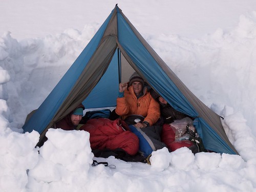
The Mega-Light is a 2 lb. tent with one pole that fits 4 people and packs...sweet
Day 2 - Crossing the Carbon and Winthrop Glaciers
Due to our initial distance handicap from the road, we knew that it would be difficult to reach Thumb Rock on the second day while moving at a moderate pace. We woke up at 5:30 and broke camp. The snow that morning was a thin layer of ice covering firm snow. We put on our crampons when we were only 300 yards out of camp.
Morning snow conditions in Glacier Basin
St. Elmo's Pass required nearly 1500' of elevation gain from our campsite to the saddle. The sun slowly rose over us, softening the snow slightly, but keeping us warm enough that we all climbed in light layers.
Stepping up the hill to St. Elmo's Pass, looking back at Glacier Basin
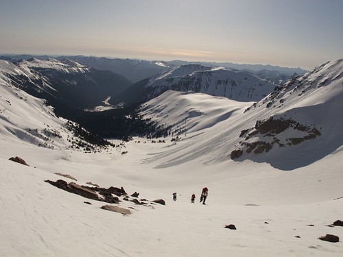
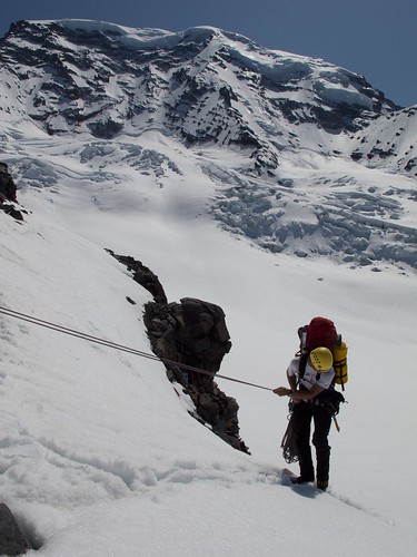
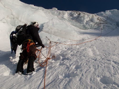
We summited St. Elmo's Pass and descended to the edge of the Winthrop Glacier where we roped up to move through potentially crevassed terrain. This was a very snowy year for the Cascades, so we did not take lightly the danger of hidden crevasses.
The expansive snow of the Winthrop Glacier
Parallel Tracks across the Winthrop Glacier as we moved in Echelon Formation
Where the glacier butts up against the adjacent rock wall, there is an eddy effect (in the same way eddies are created in a river) and a number of crevasses were opened up. We made good time crossing the Winthrop Glacier and decided to break for a snack and some shenanigans when we reached the far side. We dug some anchors and rappelled into the crevasse, being careful to bring all our ascending gear with us and never fully unroping once inside. After about 5 minutes of standing on what appeared to be the floor of the crevasse, it gave way and I was caught by my prussiks which were still attached to my rappel rope. Also, while wandering around in the bottom, we could hear strange sounds that could have been anything from nearby chunks of snow falling to the glacier itself flowing and creaking against itself. It was an eerie, beautiful and terrifying sound.
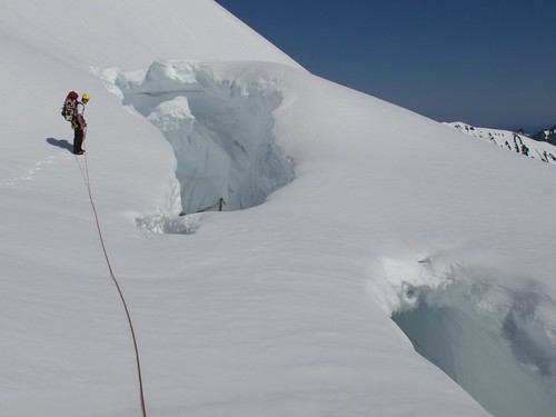
Looking into a crevasse at the West edge of the Winthrop Glacier.
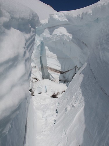
The crevasse we rappelled into
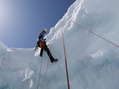
Mike showing good rappel technique
After an hour or so of practicing rappelling and ascending technique, we packed up and started across Curtis Ridge. From the topo map, it was obvious that there was a sizable cliff we would have to deal with before we could get onto the Carbon Glacier. We intended to contour around Curtis Ridge and either drop onto the Carbon Glacier at an easy spot on the cliff or rappel down We wanted to skip the potential 2 mile detour down to the moraine just to hike back up the glacier.
Hunting for a safe rappel line to the Carbon Glacier
Adam rappelling from Curtis Ridge onto the Carbon Glacier with Liberty Ridge looming behind.
After nearly 30 minutes of hiking, we found a boulder that was stable and large enough that we could rappel off a cordolette over a vertical cliff and land nearly on the Carbon Glacier. The rap was SUPER-sketchy; I think I kicked down several hundred pounds of rocks that were just perched and ready to fall. We all hid in a small cave while each successive person went over the edge. Once the last person finished their rappel, Mike realized that he had left his mountain axe at the top of the cliff.
We all took a deep breath and then discussed our options and how this would impact our climbing speed, safety and overall plan. If we continued up Liberty Ridge with one team member having only one ice tool, it might be difficult/impossible to overcome the summit ice pitch. If we walked down the glacier and back to retrieve the tool, we would waste many hours and have a difficult time climbing the next day.
There was a steep snowfield adjacent to the cliff we rappelled that we had chosen not to downclimb due to the bad runout. We all agreed that the best method was for Mike to climb up and retrieve his axe. He borrowed an extra ice tool, climbed up and returned 45 minutes later with his axe and my cordolette! No gear left behind!
Once all our sets of gear were intact, we descended to the Carbon Glacier, crossed a sketchy snow bridge (on belay) and began to climb up the glacier towards our camp near the base of Liberty Ridge.
Having saved time on the rappel, even with the delay to get Mike's axe, Adam decided to lead us on a really fun climb through the broken portions of the Carbon Glacier. We were looking down into seemingly bottomless crevasses (park literature suggests that the Carbon Glacier is 900 feet deep).
The broken section we climbed.
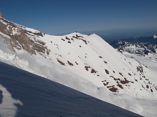
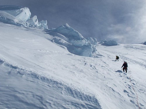
As we topped out the rollover and got onto flatter, less broken terrain, we heard a boom and watched an avalanche come down the Liberty Wall. We were well out of range of the avalanche runout, but this served as a reminder of just how serious an undertaking we were approaching.
A large avalanche coming down the Liberty Wall
We finally settled at camp at around 7:30 PM and went through the usual motions. We were all getting good at finding any group tasks that had not been done and taking initiative to keep camp running smoothly. From our vantage high on the Carbon Glacier, we could see Puget Sound reflected in the sunset and, as it got darker, the sky lit up from the glow of Seattle. We went to bed as early as our tasks were completed. The next day would be a big one.
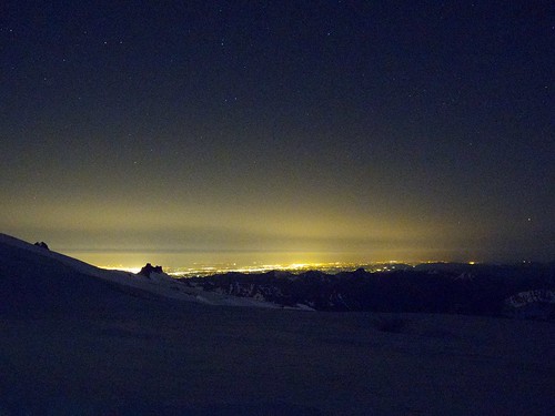
Seattle at night from the Carbon Glacier
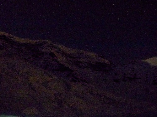
Liberty Ridge, lit only by the city lights of Seattle, some 60 miles distant.
Day 3 - The Ridge
During a standard trip up Liberty Ridge during the high season, parties will camp at Thumb Rock, approximately halfway up the ridge, wake up the next morning and summit. Once again, our lengthened approach hike (and our need to play around in crevasses and whatnot...) had slowed us down and placed a more difficult day of climbing ahead of us. The weather had shown no signs of worsening and with a clear 3-day forecast we decided that doing the entire ridge in a day would be feasible.
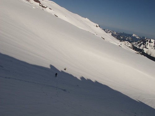
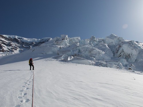
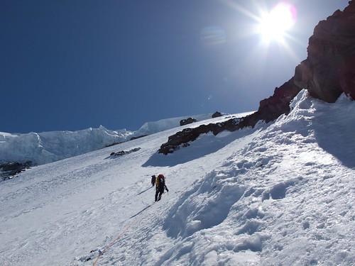
The alarm clock beeped at 1:30 AM; our first real alpine start of the trip. We made good time and were boot-axe belaying each other out of camp by 3AM. We aimed for the right side (for clarity, looking at the ridge, left is east, right is west) of the toe of the ridge and moved quickly so we could be out of avalanche terrain as quickly as possible. We climbed over a crevasse and moved up a snowfield to gain the ridge proper.
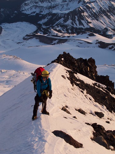
Adam on the ridge just after dawn
We stayed on the ridge as long as possible and made the decision to move to the East (left) side of the ridge when we came to an impassable rock tower. Supposedly, most ascents of the route stay primarily on the right side. We followed the best snow and smallest rockfall danger as we climbed and, we were told afterward, ended up taking a rare route.
Climbing perfect, crunchy snow, approaching Thumb Rock from the left side.
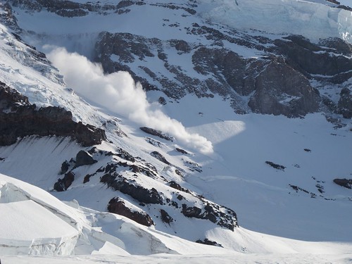
We reached Thumb Rock around 8:30AM and took a long break while we watched a second, larger avalanche rumble down the Liberty Wall.
The avalanche at its peak strength. The ridge provided us a great vantage point.
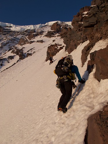
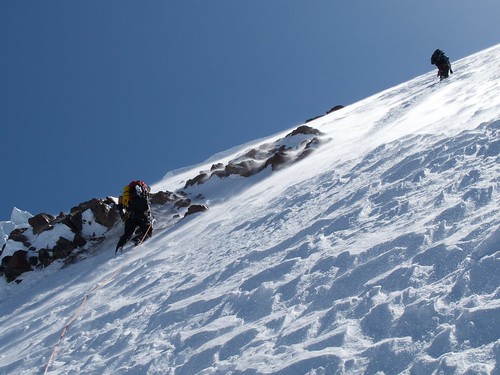
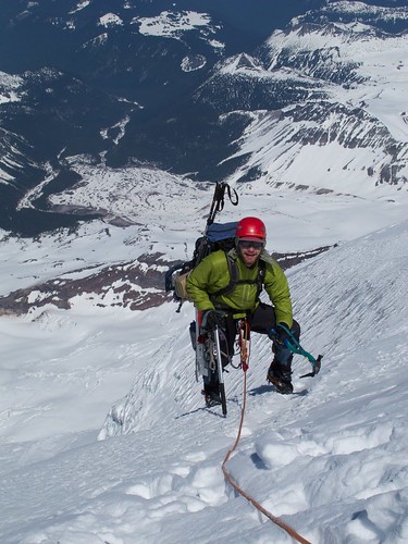
We left Thumb Rock by heading up the right side of the ridge and stayed unroped until we reached the obvious edge of the upper Carbon Glacier. Once there, Adam led and protected the snow climb with a combination of pickets and ice screws. As we moved left up a steep snowfield to regain the ridge, I heard the dreaded word.
When someone says "rock" and their tone could be used to tell someone that they don't need their grocery receipt, blood pressure does not rise, quick action is not generally taken. This is not how Erik said it. He screamed "ROCK" in that tone reserved for people who cut you off in traffic or for scaring small children. I slammed myself to the ground and turtled my pack uphill. I felt a few skittering pebbles bounce off my helmet and Erik and Adam yell "Clear! Now let's GTFO!" I found out later that the rock was close to the size of a watermelon and did not come from any obvious rockfall hazard we could see.
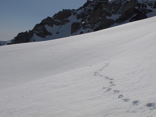
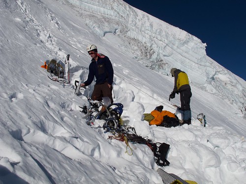
We regained the ridge shortly thereafter and took a break. It was 1:00PM and we had burned through our water so we decided to stop and melt everybody 2 more liters. This process gave us enough time to rest our legs and get some snacks.
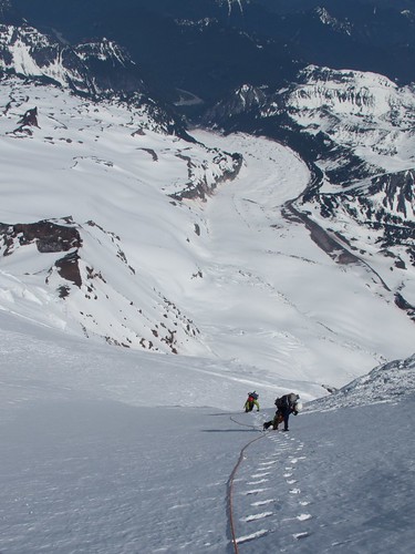
We left our rest spot roped and headed out left and up what would be the last snowfield before the summit glacier (though it was close to 1000 vertical feet of continuous snow climbing)
Footprints up to our break spot.
Leaving our break spot for the push to the Black Pyramid
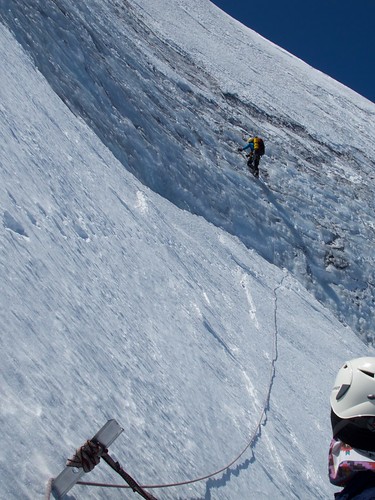
This section epitomized the slog. Erik led the climb, placing just enough pro that we had one piece to catch the team if self arrest failed. We stepped slowly up the snow, moving slowly enough that I had to clear spindrift out of each step before I could use it. The exposure and the beauty of that place, combined with the intense physical exertion made it a very meditative experience; I lost myself and just concentrated on moving uphill when the rope going to Erik went taut.
Walking slowly through light spindrift on a bluebird day.
Moving slowly uphill
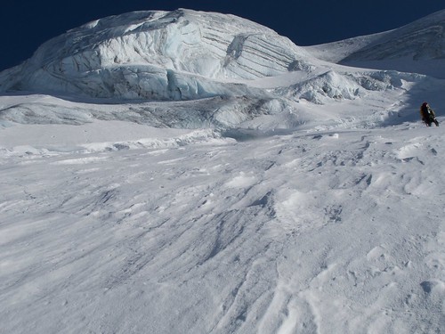
Finally reaching the beautiful ice of the Liberty Cap
After a nearly immeasurable amount of time, the snowfield began to ease in slope and we moved faster until, at about 5:00PM we reached the bergschrund of the Liberty Cap. We discussed options and decided that we would not summit that night, we would camp at the base of the summit glacier at around 13,500'. Adam would climb the short section of ice separating us from the real summit ice pitch and see if there was a good spot to set up camp for the night. He led a short ice ramp and, deciding there was no good place to build a camp, built an anchor, set a fixed line down to camp and rappelled back down to us.
Mike, belaying Adam up the short ice ramp.
Since we were on a nearly 45 degree snow slope, the only option to set up the shelter was to dig into the slope to create a large enough flat spot so we could camp. The four of us started digging at around 9PM and were finished at about midnight. We did the camp basics of making water, cooking dinner and passing out. A brilliant red sunset reflected off Puget Sound. Once again, the weather showed no signs of gathering. If we woke up to clear weather, we would have no problem escaping any weather that was on its way.
We finally got to bed at 1:30AM after our hardest and longest day; we had climbed steep snow for nearly 7000' of vertical gain and it had taken us 24 hours. We decided not to set an alarm.
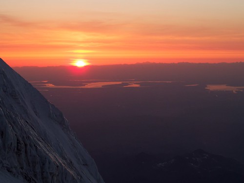
Sunset over Puget Sound
Our camping platform
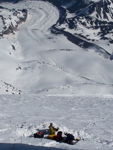
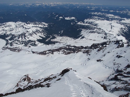
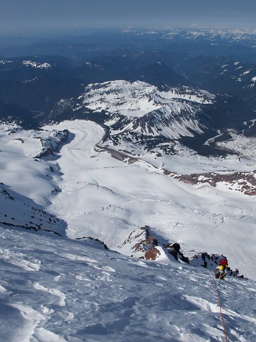
The view down at our camping platform and on down to the Carbon Glacier, nearly a mile and a half below us.
Day 4 - Summit and Back to the Cars
Even after that long day, I woke up at 6AM and started getting my pack ready. We took it slow getting out of camp and were finally prussiking our way up the fixed line at 9AM. We climbed another few hundred feet of steep snow to the base of the summit ice pitch. The pitch was a 60 degree slope with 30' of perfect, blue alpine ice.
Our tactics for this portion had been worked out in advance. Adam would lead the pitch on one full 60m rope, build a bomber anchor (he used two snowshoes buried separate as deadmen) and then belay the 3 of us up. Since we only had two ropes, and Adam needed one to lead the climb, the three followers were all climbing simultaneously on the same rope. Each person would only move when there was sufficient slack below to indicate the person below them had moved up. We moved efficiently and climbed the pitch without incident.
Steep snow approaching the ice pitch, looking down at the Carbon Glacier
Adam leading the beautiful ice

The lower belay station for the ice pitch
Erik tops out!
From this point on, we moved roped without pro and climbed the last few hundred feet to the Liberty Cap summit (14,112'). We reached the summit and took out the Rainier Beer we had brought along and everyone had their victory 4oz. We decided not to try for the Columbia Crest (the true summit of Mt. Rainier at 14,410') for a few reasons; partially, it was out of our way for a direct descent, we felt like we had succeeded on the route we came to climb, and our group's philosophy has always been about the climb not the tick of the summit. Others have different philosophies, ours is about not letting our egos push us into making bad decisions; turning back before the true summit helps entrench that ideal. And Rainier Beer, this climb was all about the beer.
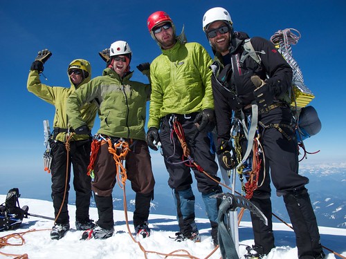
Summit of Liberty Cap!!!! (left to right, Adam, Mike, Erik, Page)

Popping open that sweet beery goodness
Knowing that we had a long descent ahead of us, we only lingered for 15 minutes or so and then headed towards the top of the Emmons Glacier for our descent. Adam has a reputation for being the fastest person any of us have ever met on the descent. He was moving fast enough down the Emmons Glacier that we had to tell him to slow down so as not to pull us off our feet while roped up. Since it had been a heavy winter, there was almost no routefinding necessary to descent to Camp Schurman (the ranger hut on the northeast shoulder of the mountain). We left our summit at 3:30 PM and were down at Camp Schurman by 5:45PM (and had descended more than 4,500 feet in the process).
Big Seracs on the Descent
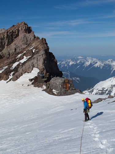
The Camp Schurman hut (still too early in the season to be staffed)
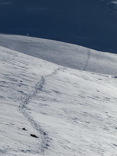
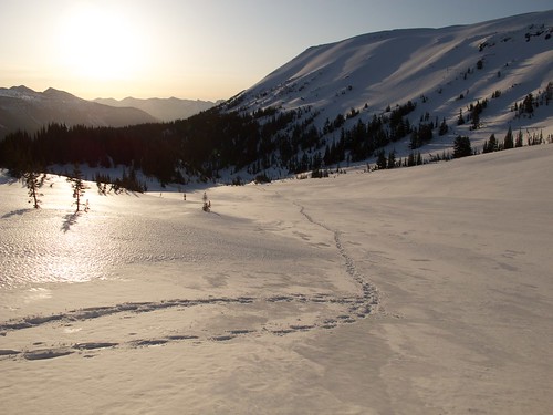
Footprints of our descent
The standard descent from Camp Schurman is to climb up and over the Steamboat Prow (the rock prow behind the hut) via a snowfield and descend into Glacier Basin; where we had camped the first night. We looked down the lower reaches of the Emmons Glacier and could see no obvious reason not to take that straightforward, downhill walk over a smooth snowfield. We found out later that that portion of the glacier is usually so broken that it is too time-consuming and dangerous to consider descending. We walked/skated down the glacier in our snowshoes and were back at the White River Campground before dark.

One last look back at the mountain, the Liberty Cap summit is the farthest right of the 3 summit domes.
Once we were back at the White River Campground, we loaded the sled with the sharps/heavies, drained the celebratory beers we had left there and took turns hauling the sled. The 6 miles of road was probably the longest 6 miles I have walked in my life. We pushed ourselves so we could make it back to the car that night and were making 20-minute miles down the road. It seemed interminable. I counted in my head to distract from the pain in my feet and the boredom of the road; I got to 2000 before I stopped counting.
We made it back to the car at 3AM after having hike almost 14 miles from our high camp. Carefully, we drove back into the nearby town of Packwood, WA. Looking for sustenance, we wandered into a 24-hour gas station convenience store and asked if there were any restaurants nearby; the counter jockey told us no. We decided that having microwave gas station burritos was better than not having microwave gas station burritos, so we had a gas station feast. There was a hotel a mile down the road that had an attendant available in the middle of the night. We went in and crashed hard.
Drying gear in the hotel parking lot.
In all, it was a unique experience of the mountain; no people, 4 days of perfect bluebird weather, first tracks of the year on Liberty Ridge and the street cred of having walked the extra 6 miles in and out on the road.


